Jeju to come under direct influence of powerful typhoon Tuesday night

SEOUL, Aug. 25 (Yonhap) -- South Korea's southern resort island of Jeju is set to come under the direct influence of the powerful Typhoon Bavi, beginning Tuesday evening, meteorologists said.
The Korea Meteorological Administration (KMA) said that as of 9 a.m., the eighth typhoon of the season, formed off the east coast of Taiwan, was traveling northward at 16 kilometers per hour from waters 460 km south-southwest of Seogwipo on Jeju Island. Its central pressure was 960 hectopascals, with its maximum wind speed recorded at 39 meters per second.
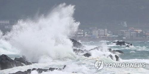
Strong waves pound the southern shores of Jeju Island on Aug. 25, 2020, as Typhoon Bavi approaches the Korean Peninsula. (Yonhap)
Due to the approaching typhoon, Jeju is to be hit by very powerful winds with speeds of 10 to 20 meters per second, or instantaneous maximum speeds of 40 to 60 mps, from Tuesday night, the agency warned.
Typhoon Bavi is forecast to be closest to the southern island Wednesday afternoon and move north along the nation's west coast before making landfall in North Korea's Hwanghae Province on Thursday.
The typhoon will also move nearest to Seoul Thursday morning, while bringing very strong winds and heavy rains to the entire nation, the KMA said.
Therefore, the southwestern coastal areas in the Jeolla provinces will be affected by very strong winds with maximum instantaneous speeds of 40 to 60 mps, or 144 to 216 km per hour, while the instantaneous wind speeds will also reach up to 35 mps in other western and southern coastal areas, it warned.
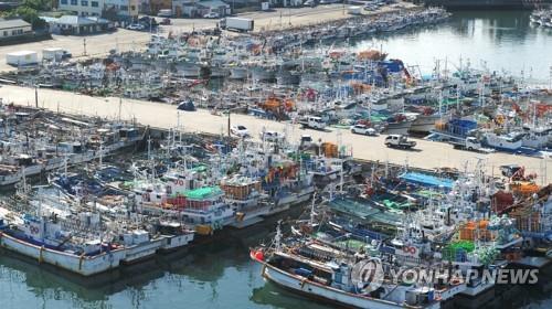
Hundreds of fishing vessels lie at anchor at a port on Jeju Island on Aug. 25, as Typhoon Bavi approaches the Korean Peninsula. (Yonhap)
If wind blows at speeds of between 40 to 60 mps, people cannot walk around and facilities can be blown away, damaged or broken.
The KMA cautioned that the typhoon is expected to disrupt aircraft operations in most parts of the country and deal significant damage to street and agricultural structures, among others.
Rain will gradually expand from Jeju, beginning Tuesday, to the southern regions Wednesday morning and the central regions in the afternoon. Rain will continue nationwide until Thursday.
Precipitation is forecast to reach 100 to 300 millimeters on Jeju Island and in the southwestern provinces of Jeolla over the next three days, while other areas will receive 30 mm to 150 mm in the same period, the KMA said.
The agency has already issued a typhoon alert for the high seas south of Jeju and a preliminary wind-wave alert for the seas around Jeju and the southern and southwestern coasts.
ycm@yna.co.kr
(END)
-
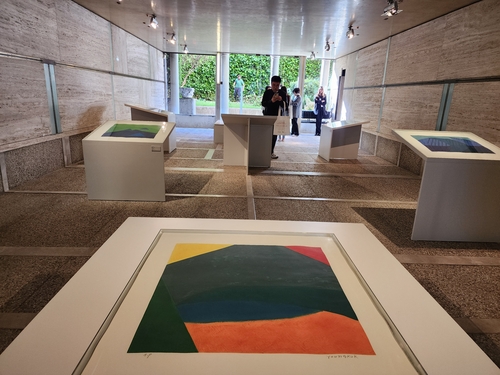
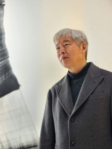
 Overdue debut of Korean abstract art pioneer Yoo Young-kuk at Venice Biennale
 -
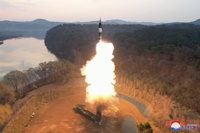 Defense chief says N. Korea's hypersonic missile 'unsuccessful' in last-stage glide flight
 -
 Relax, immerse yourself in scents at Venice Biennale's Korean Pavilion
 -
 N. Korea has capability to genetically engineer biological military products: U.S. report
 -
 S. Korea marks 30th anniv. of Korean Pavilion at Venice Biennale with contemporary art


-
 Overdue debut of Korean abstract art pioneer Yoo Young-kuk at Venice Biennale
 -
 Relax, immerse yourself in scents at Venice Biennale's Korean Pavilion
 -
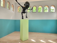
 Artist Lee Bae captures ethereal Korean aesthetics at Venice Biennale
 -
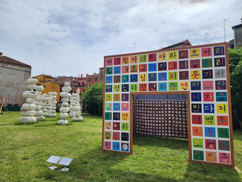 S. Korea marks 30th anniv. of Korean Pavilion at Venice Biennale with contemporary art
 -
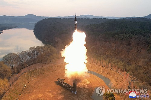 Defense chief says N. Korea's hypersonic missile 'unsuccessful' in last-stage glide flight


-
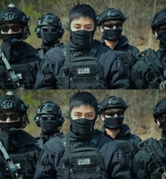 Facebook page unveils photos of BTS member V in counter-terrorism unit gear
 -
 Gov't likely to accept university chiefs' request to lower med school enrollment quota
 -
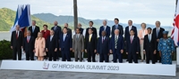 S. Korea not invited to G7 summit meeting this year: sources
 -
 Yoon's approval rating sinks to lowest point since taking office
 -
 S. Korea to fully shift to 'endemic' from COVID-19 pandemic starting next month